


With permission, I am publishing below a longer version of that article. Consider the Streetsblog version the what-you-need-to-know, and this Substack version a deeper dive that includes more discussion of Low Traffic Neighborhood design principles and additional Clinton Street traffic data.
The Lower East Side (LES) in Manhattan is one of the most dense, walkable neighborhoods in New York City. Take a stroll around its historic streets – Orchard Street, Ludlow Street, Essex Street, and so on – and regardless of the time of day or season of the year, you will see the sidewalks full of pedestrians.
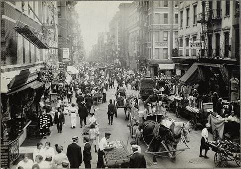
In fact, the LES streets are famously and historically known for their lively street activity. And while the neighborhood is not quite as crowded as it was in those peak 20th-century immigration days, lively streets remain a LES hallmark. Yet the design of the streets themselves does not support the needs or current utilization by residents, over 80% of whom do not own a car.
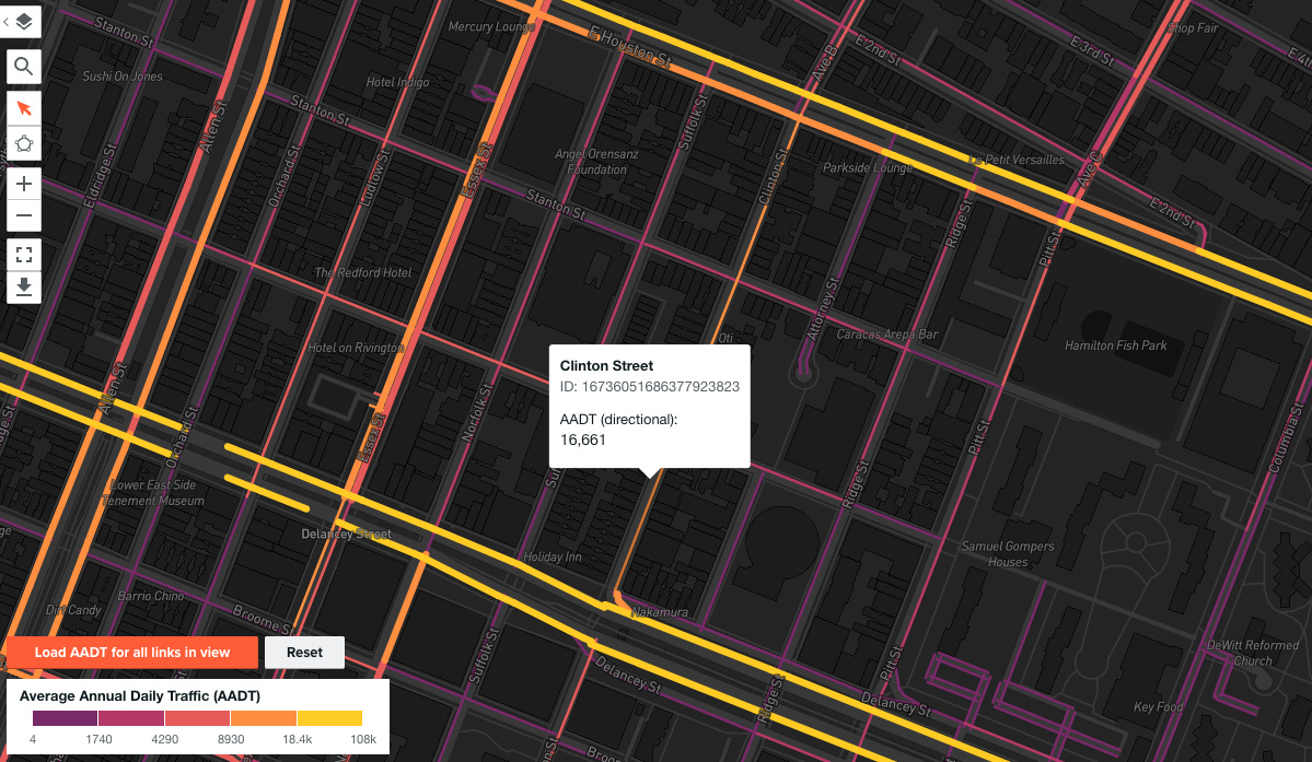
One particularly egregious case is the segment of Clinton Street between Delancey Street and Houston Street. This single corridor receives 4-6x the vehicular traffic of its neighboring streets, despite being of a similar width and packed with pedestrians due to its mixed-use nature, boasting both commercial and residential uses.
Clinton Street cannot continue to manage 16,000 cars per day entering it. The astonishingly high volume of vehicular traffic on this road, combined with its equally high usage by pedestrians and cyclists, has resulted in a dangerous and untenable situation. Intersections on this corridor have been rife with crashes resulting in pedestrian injuries, and locals encounter traffic jams throughout the day, impeding residents’ mobility and worsening quality of life for those with and without a car.
I’ve written before about how the LES is a prime location for a Low Traffic Neighborhood (LTN). LTNs achieve less traffic (including on the boundary roads they funnel cars towards) and fewer casualties simultaneously by redesigning residential streets using proven urban planning principles. The strategic arrangement of local roads allows for flexibility in each neighborhood’s LTN design by removing dangerous through-traffic while prioritizing residents’ needs. You can read more about what LTNs are and the evidence on how they improve the health, safety, and economic outcomes for residents here.
In this post, I would like to make the case for why Clinton Street presents an excellent candidate for an LTN redesign. By making a few minor but pivotal changes to the design of the roadway, the NYC Department of Transportation (DOT) could transform life for both residents and the many tourists and visitors who frequent this street in the heart of the LES. Key to this is one simple change: removing vehicle access from a single point on Clinton Street.
The Primary Culprit: The Williamsburg Bridge Off-Ramp
Anyone who lives in the LES or has spent time around the section of the City around Delancey Street can immediately point to why traffic on Clinton Street is so much higher than neighboring streets: the Williamsburg Bridge off-ramp. For vehicles traversing this East River bridge from Brooklyn’s Williamsburg to Manhattan’s LES, the first opportunity to exit the bridge roadway is to make a right turn onto Clinton Street.
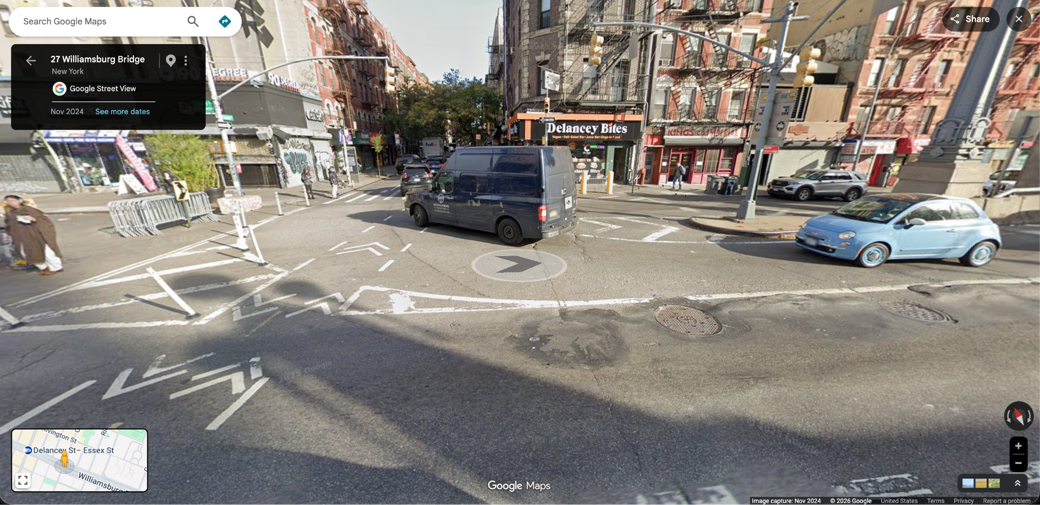
Drivers coming off the four-lane road on the bridge turn directly onto a one-lane, one-way roadway shared with a bike path and busy sidewalks on either side. This leads to a dangerous situation where cars are often barreling onto the local road or speeding through the red light entirely. On that same off-ramp are heavily utilized crosswalks and bike paths often packed with cyclists and pedestrians navigating the Williamsburg Bridge entrance themselves. Further, in the immediate area are dozens of bars, restaurants, a public school (P.S. 140), and a public park (Hamilton Fish Park).
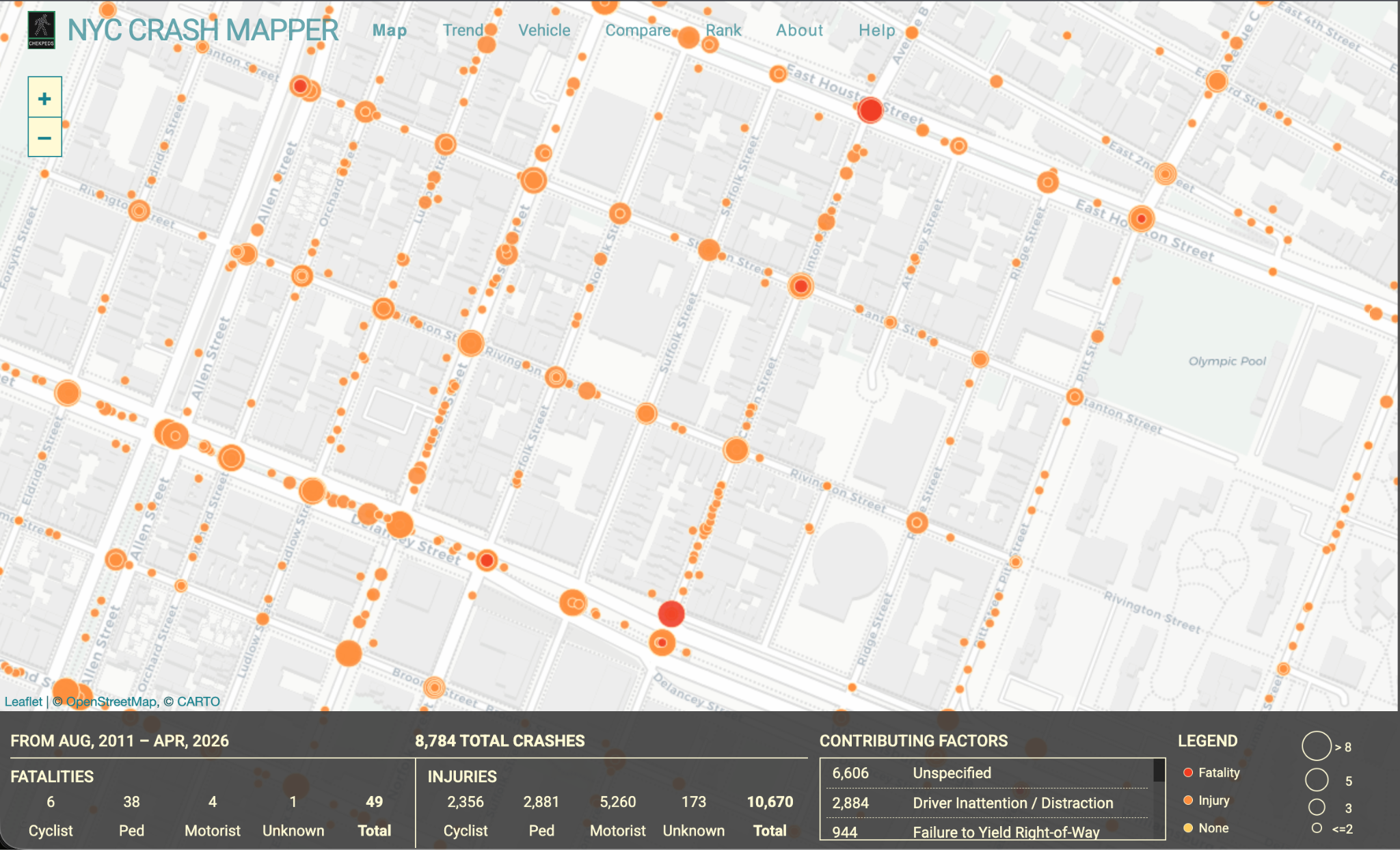
The result has been dozens of crashes leading to dozens of pedestrian, cyclist, and motorist injuries as well as a handful of fatalities in the past decade. The Clinton-Delancey intersection is one of the most dangerous in all of the LES. And while the Mayor made headlines in his first week by paving over the infamous Williamsburg Bridge bike bump, nothing has been done to address the situation at the nearby intersections that have caused a constant stream of injuries and deaths.
A Small, Residential Street Clogged With Pass-Through Traffic
The Williamsburg Bridge carries a major thoroughfare, connecting to the Brooklyn-Queens Expressway, thus providing one of the primary means of car travel between Manhattan and Brooklyn. This means there is a constant procession of traffic trying to utilize this off-ramp, as multiple lanes of traffic converge onto this single-lane road.
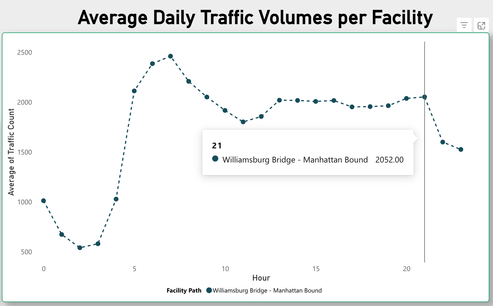
During many hours of the day, drivers do not actually enter speedily onto Clinton Street, because there is simply too much traffic to allow doing so. Using the DOT’s data, we can see that there are elevated vehicle counts on this segment of the Williamsburg Bridge crossing Clinton Street throughout the entire typical weekday. Despite being a one-way road, the corridor sees at least double, and compared to many other streets, 4-10x the amount of cars as bordering roads.
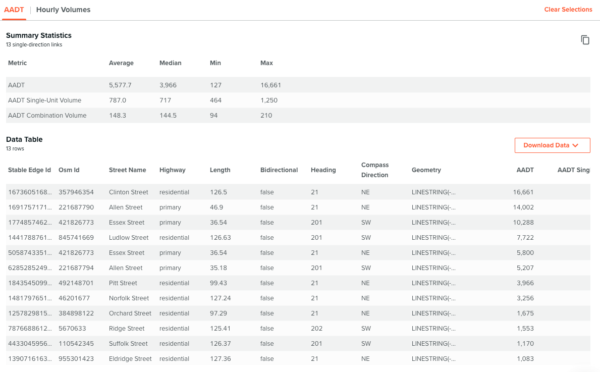
The vast majority of these cars are not driven by residents. The latest US Census ACS data shows that only 5.5% of LES residents commute to work by car. At the same time, among the top 311 complaints for Clinton Street are: illegal parking, street/sidewalk noise, for-hire vehicle complaints, and traffic. Residents are suffering from the noise and crowdedness effects of a small street being used by pass-through traffic without benefitting from the roadway access.
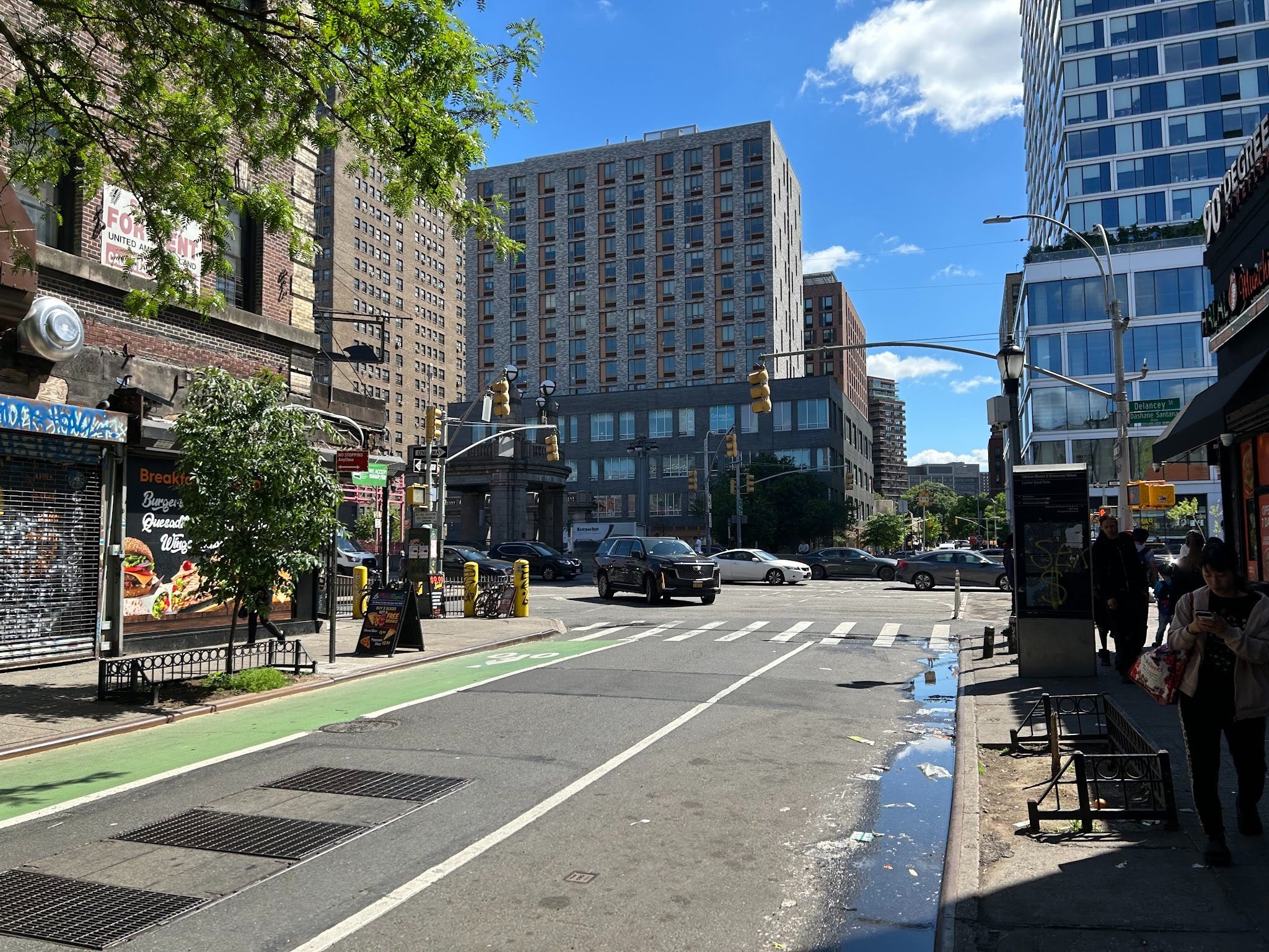
Of course, there are many more businesses and restaurants on Clinton St compared to the neighboring streets like Attorney and Norfolk. Trucks supplying these restaurants and customers taking cars or rideshares to frequent these stores undoubtedly contribute to the traffic volume. But ultimately, the data shows vehicles coming off the bridge are by far the biggest factor contributing to current conditions. A redesign of the street, particularly reducing Williamsburg Bridge traffic turning onto Clinton Street, could dramatically improve living standards while maintaining access to delivery and emergency vehicles.
Clinton Street Is Primed for a Low Traffic Neighborhood Redesign
A few minor changes to the road to reduce congestion along Clinton Street can make it a safer, more enjoyable pedestrian experience while simultaneously improving accessibility for residents and trucks supplying businesses. This is the concept embodied by LTNs, which propose cost-effective street redesigns utilizing paint on the ground and cheap flexposts to re-route traffic.
The benefits of LTNs are numerous. According to Open Plans, previous LTNs have resulted in a 46.9% drop in overall traffic volume and a 1.6% decrease on boundary roads. They have led to 50% reduction in car-related casualties, a 10-18% reduction in crime, 5.7% decrease in the concentration of nitrogen dioxide, and 25% more active travel. In London, LTNs prevented 37 deaths and half a million sick days annually. Redirecting vehicles that would have used Clinton Street simply to pass through to other neighborhoods could bring similar benefits to the LES.
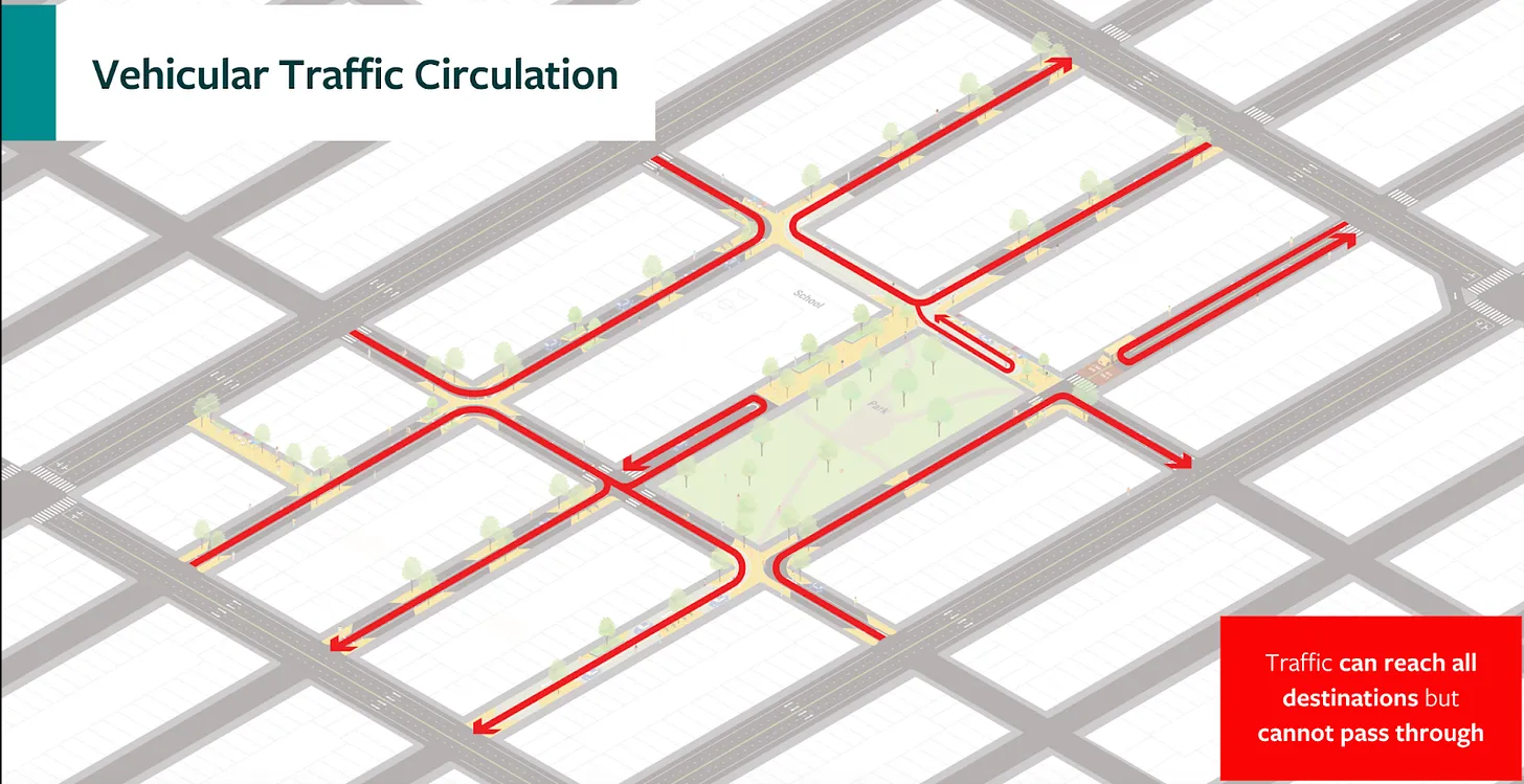
Directly north of this section of Clinton Street, when it crosses Houston Street, it becomes Avenue B. In my previous post arguing for an Avenue B LTN, I wrote about how Avenue B is a diverse, dense urban street featuring an amalgamation of public schools, restaurants and bars, community gardens, and homes (sound familiar?). DOT Street User Count data found an average of 5x as many pedestrians on Avenue B as cars at peak hours, and equal numbers of bikes as cars. Residents have also shown a desire for improved pedestrian access, with 65% of 2021 Vision Survey respondents wanting the avenue to be permanently redesigned to be more pedestrian-friendly.
While the same data is not available for the southern portion of Avenue B (Clinton Street), it is a safe assumption that the street utilization and NYC DOT survey results are just as true for the same road in the blocks south of Houston Street as they are in the blocks just north of it. Yet while Avenue B is receiving an extensive redesign by the DOT, no changes are planned for Clinton Street right next door.
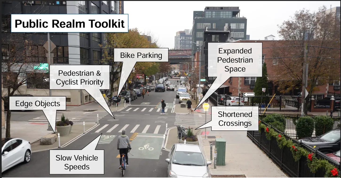
The major plank of Clinton Street’s redesign should be the removal of the dangerous Manhattan-bound Williamsburg Bridge off-ramp onto Clinton Street. Vehicles desiring to turn north into Manhattan can instead be routed onto Essex Street and Allen Street. These nearby streets can safely accommodate a much higher volume of traffic. Clinton Street itself would remain open to local residents and delivery vehicles, but without the endless procession of pass-through traffic clogging roads and endangering pedestrians.
Establishing permanent LTNs provides the greatest potential for pedestrian safety and permanent improvement in residential livability while capitalizing on cost-efficient solutions and lower administrative overhead in the long term. DOT should extend its current Avenue B redesign several blocks south (the current proposal covers East 4th to East 12th Streets) and include the connected Clinton Street segment down to Delancey Street.
As a fellow LES neighbor who feels the pain of Clinton Street every day, I really enjoyed this piece. One thing I think is missing, though, is that Clinton has two related traffic problems, not just one.
The Williamsburg Bridge off-ramp is absolutely a major contributor to the congestion and safety issues you describe. But the other half of the problem is the traffic heading TO the bridge. A huge volume of cars exits the FDR and is funneled onto Clinton Street before continuing north to the Williamsburg Bridge. So the bottleneck doesn't actually begin at Delancey, it starts several blocks south, where Clinton has effectively become a regional through-route in addition to a bridge off-ramp.
I'd love to see a proposal that tackles both directions. In addition to rerouting traffic coming off the bridge to Essex and Allen as you suggest, I'd also explore diverting FDR traffic heading to the bridge onto Madison Street—a wider two-lane roadway—and then East Broadway to access the bridge. That would take a significant amount of pass-through traffic off Clinton in both directions and allow it to function much more like the neighborhood street it should be.
I used to live right there and thought about this every day, thank you so much for writing the piece. Do you have any suggestions on how we could campaign for this change?