
An Inside Look at the East Side Coastal Resiliency Project
Notes from an on-site tour with the NYC Department of Environmental Protection

Earlier this month, I joined a tour of the East Side Coastal Resiliency (ESCR) project led by representatives from the NYC Department of Environmental Protection (DEP). The ESCR project has reshaped Manhattan’s waterfront from Battery Park up to 23rd Street in an effort to prevent coastal flooding, such as what occurred during Hurricane Sandy in 2012. I have previously covered a smaller portion of the ESCR redevelopment that renovated the East River Park and discussed the new amenities. In this post, I will focus more on the actual flood-mitigation elements and the design and urban planning considerations.
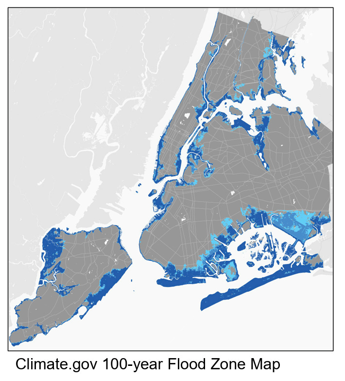
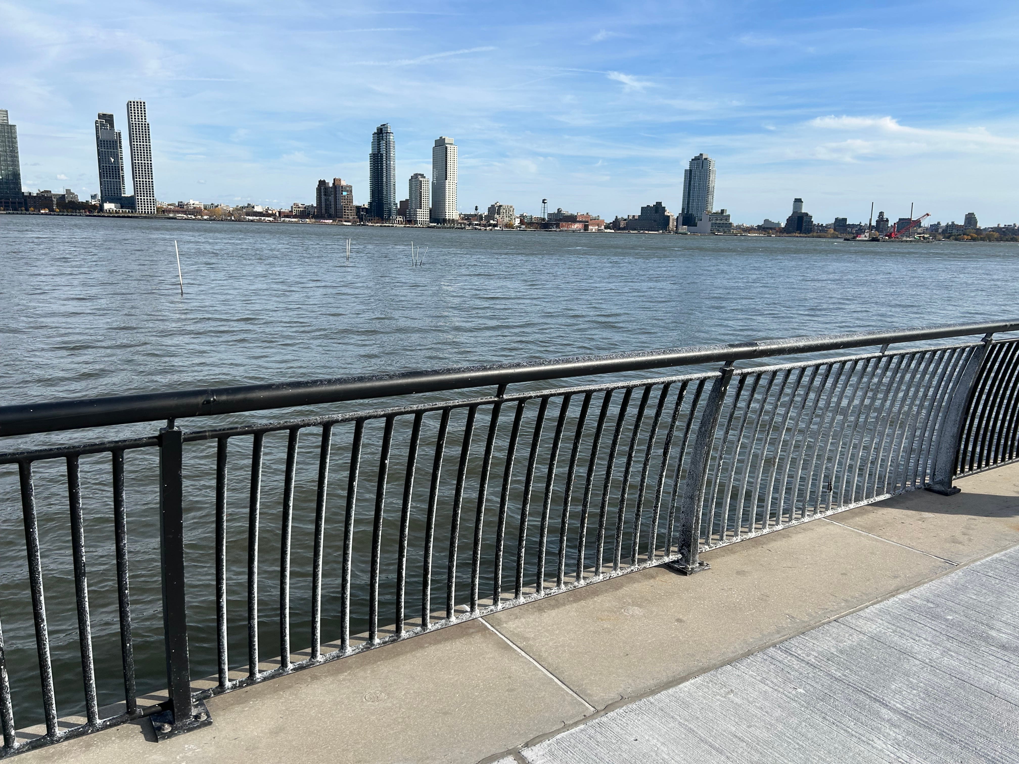
The tour covered the stretch of coastline from 23rd Street south toward Stuyvesant Cove and offered a comprehensive look inside how the city is designing, funding, and managing one of its largest climate infrastructure projects. Just this 2.4-mile stretch of coastal redevelopment involved billions of dollars in funding, dozens of movable floodgates, and lessons learned by the City on inter-agency coordination and how to balance design with functionality. Below are my notes from the tour, grouped by theme.1
1. The Coastal Resiliency Bureau
The Coastal Resiliency Bureau is new, only about two years old. It now manages about 520 miles of coastline governed by NYC.
It was placed under DEP, which focuses heavily on operations, since most coastal resiliency work is operational in nature.
Coastal Resiliency encompasses three functions: design, planning, and engineering.
PlaNYC’s 2023 update called for a centralized team to coordinate all citywide coastal efforts, which launched the creation of the Coastal Resiliency Bureau.
Coastal resiliency work now sits within the city’s purview, requiring new institutional structures, technical expertise, and local coordination.
Each project includes institutional, technical, and financial components, all of which must align for a project to move forward.
The Bureau is still refining models that project wave heights for the next 100 years—projections that remain uncertain but essential for long-term design.
2. The ESCR and Its Scope
ESCR is a $1.5 billion project covering just 2.4 miles of Manhattan’s east side and is a core segment of the broader “Big U” redevelopment, stretching from 23rd Street down the coast to Battery Park.
The project is about halfway complete; the adjacent Brooklyn Bridge–Montgomery Coastal Resiliency (BMCR) project is set to finish in 2026. Several additional projects remain in the design stage.
They are developing standard operating procedures and standardized designs to guide future work. This entire team was formed from scratch only two years ago and had to learn how to operate quickly.
The entire coastal resiliency and emergency response framework is new for the city, representing a significant operational and institutional learning curve. Only following Hurricane Sandy in 2012 did the city government begin to think seriously about coastal resiliency and flooding management.

3. Emergency Response and Hurricane Planning
The city’s emergency response plan for flooding activates in stages:
96 hours before a hurricane: initial actions begin to prepare for potential flooding.
72 hours before: the Mayor’s Office and NYC Emergency Management (NYCEM) activate full plans.
36–48 hours before: they begin closing floodgates (more on this below).
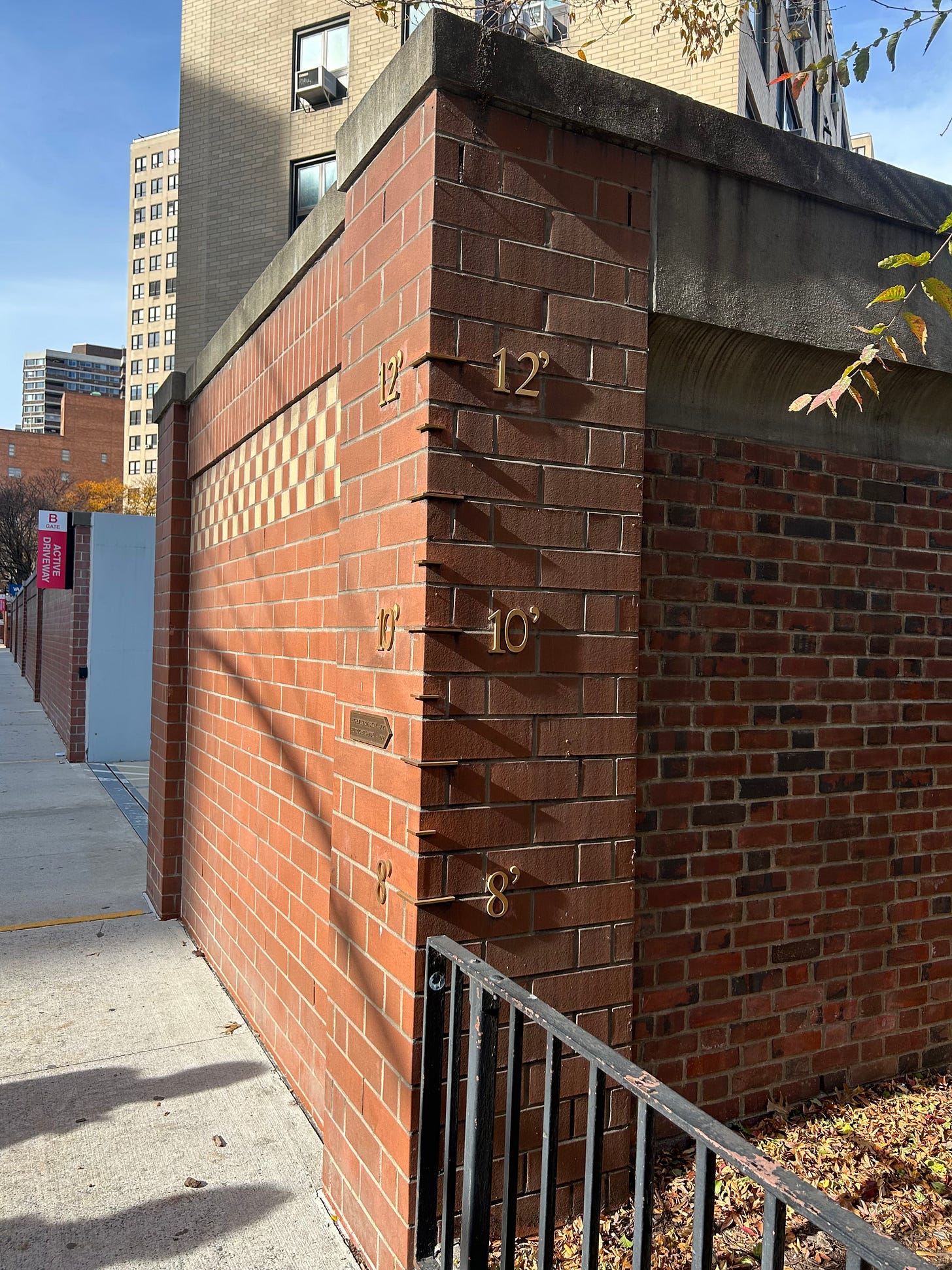
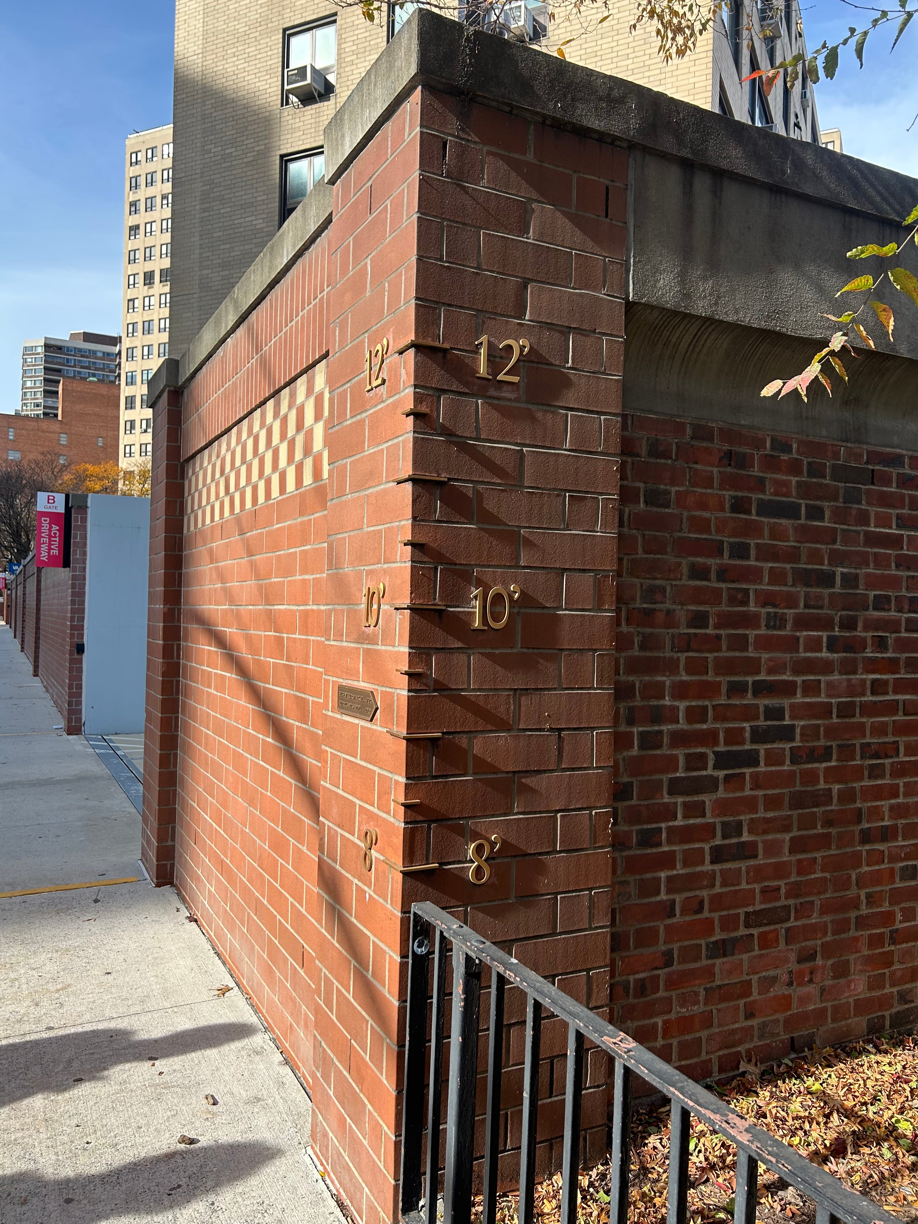
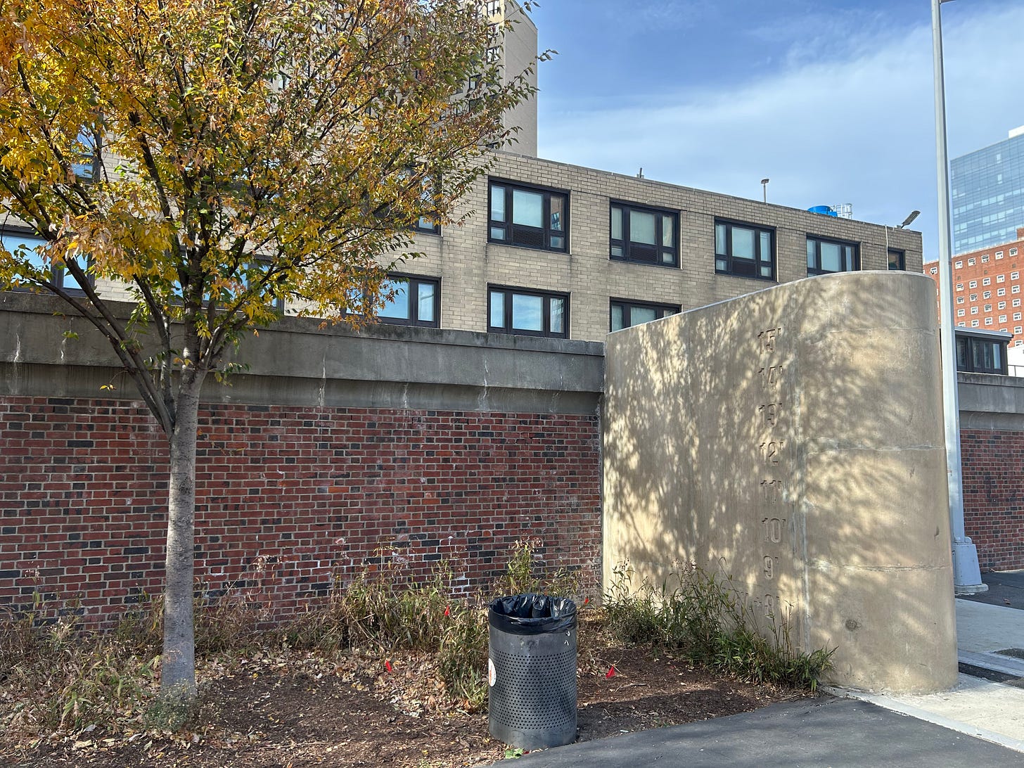
Hurricane Sandy’s water levels reached 9.2 feet above sidewalk level, marked by a plaque on 23rd Street.
Flooding from Sandy was primarily due to storm surge, not rainfall. The city is also building infrastructure to manage future rainfall and sewer overflow flooding, such as creating a pipeline emptying into Newtown Creek in Brooklyn.
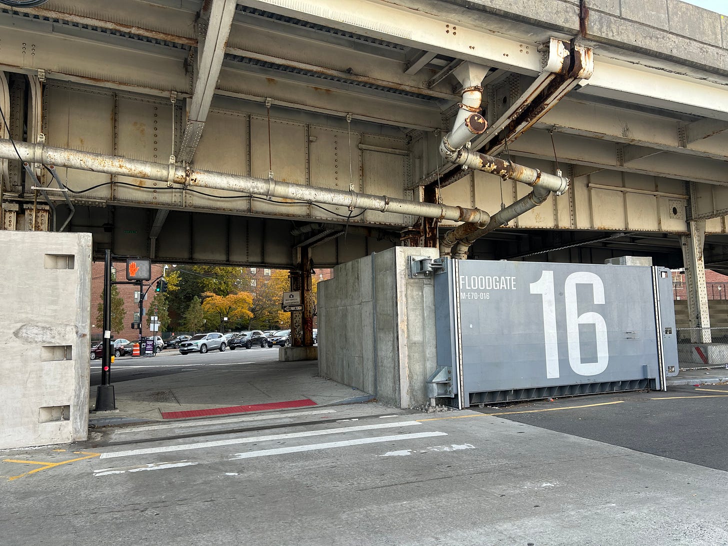
4. Gate Design and Operations
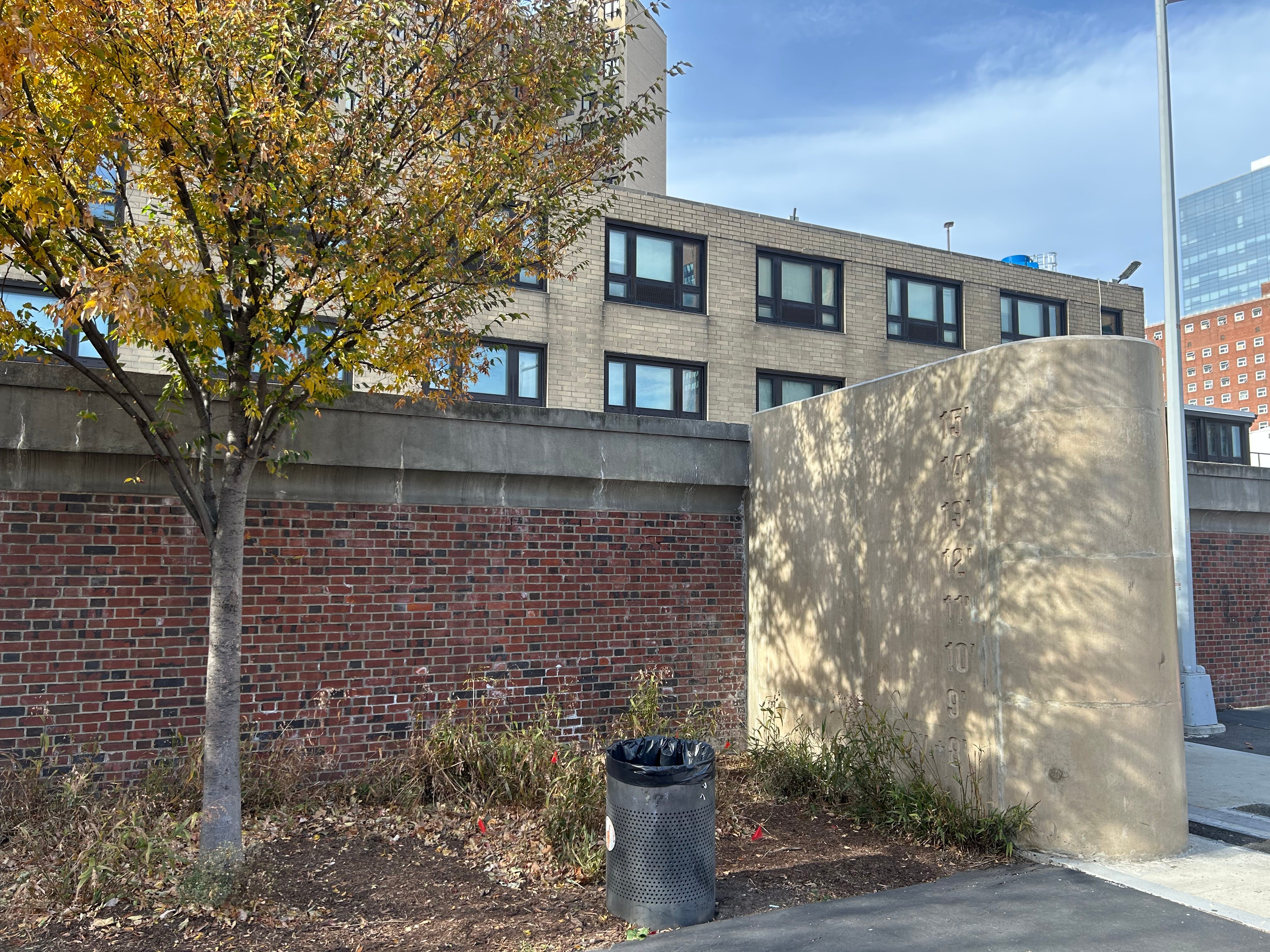
The VA Hospital on 23rd Street has both automatic floodgates and permanent brick flood walls. The ground elevation increases as you move toward 1st Avenue (westward), which is why the flood wall gradually lowers to the street level.
Gates are classified as low-impact (closed 24 hours before a storm, then they wait in case the storm changes paths or lessens in severity) and high-impact (closed several hours before a storm, such as those along the FDR). Designations depend on how closing the gate will impact traffic and accessibility between the waterfront and interior.
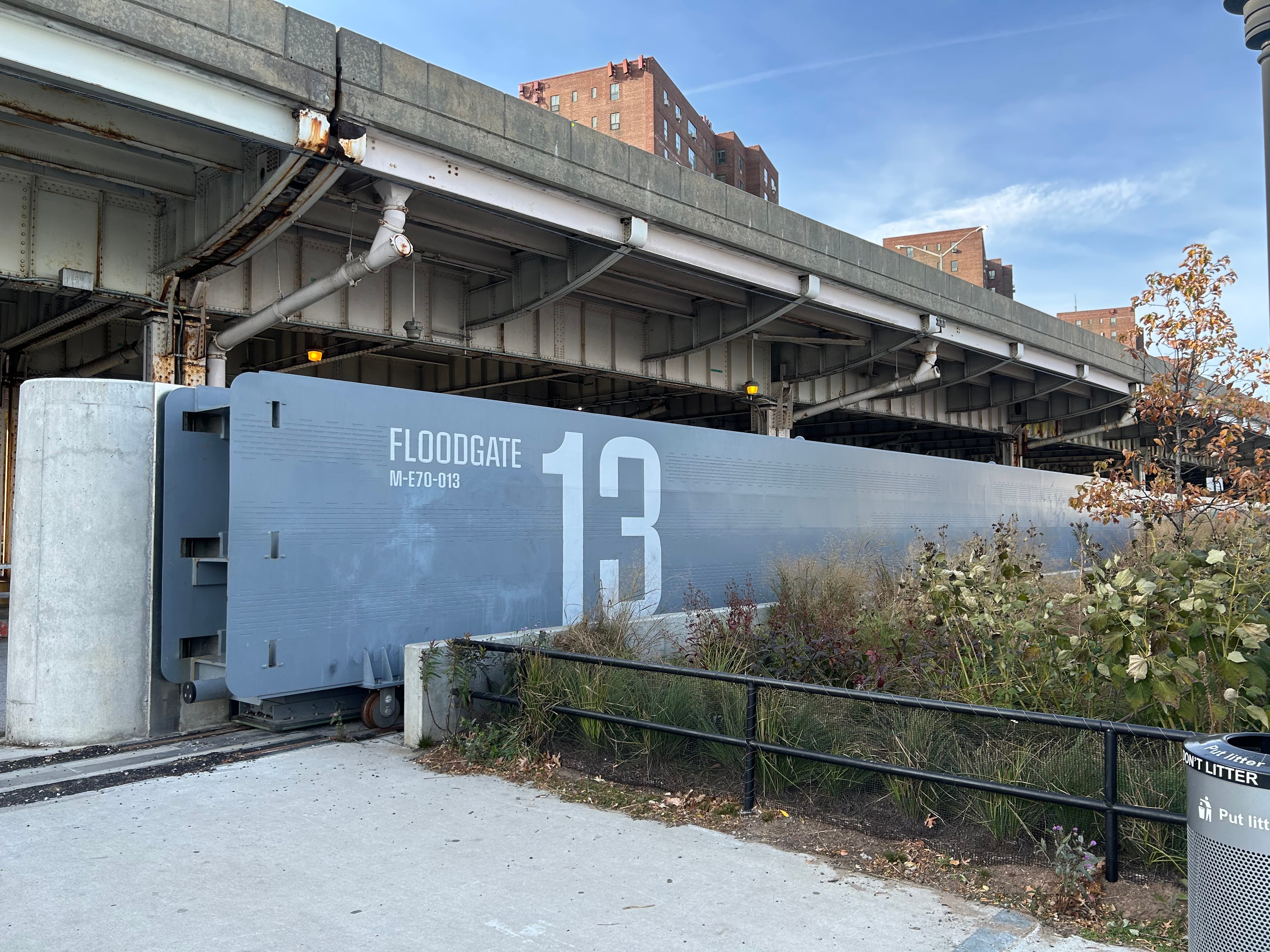
DEP coordinated gate design and function with the Parks Department and NYCEM, balancing functionality and aesthetics across all 18 gates in this section.
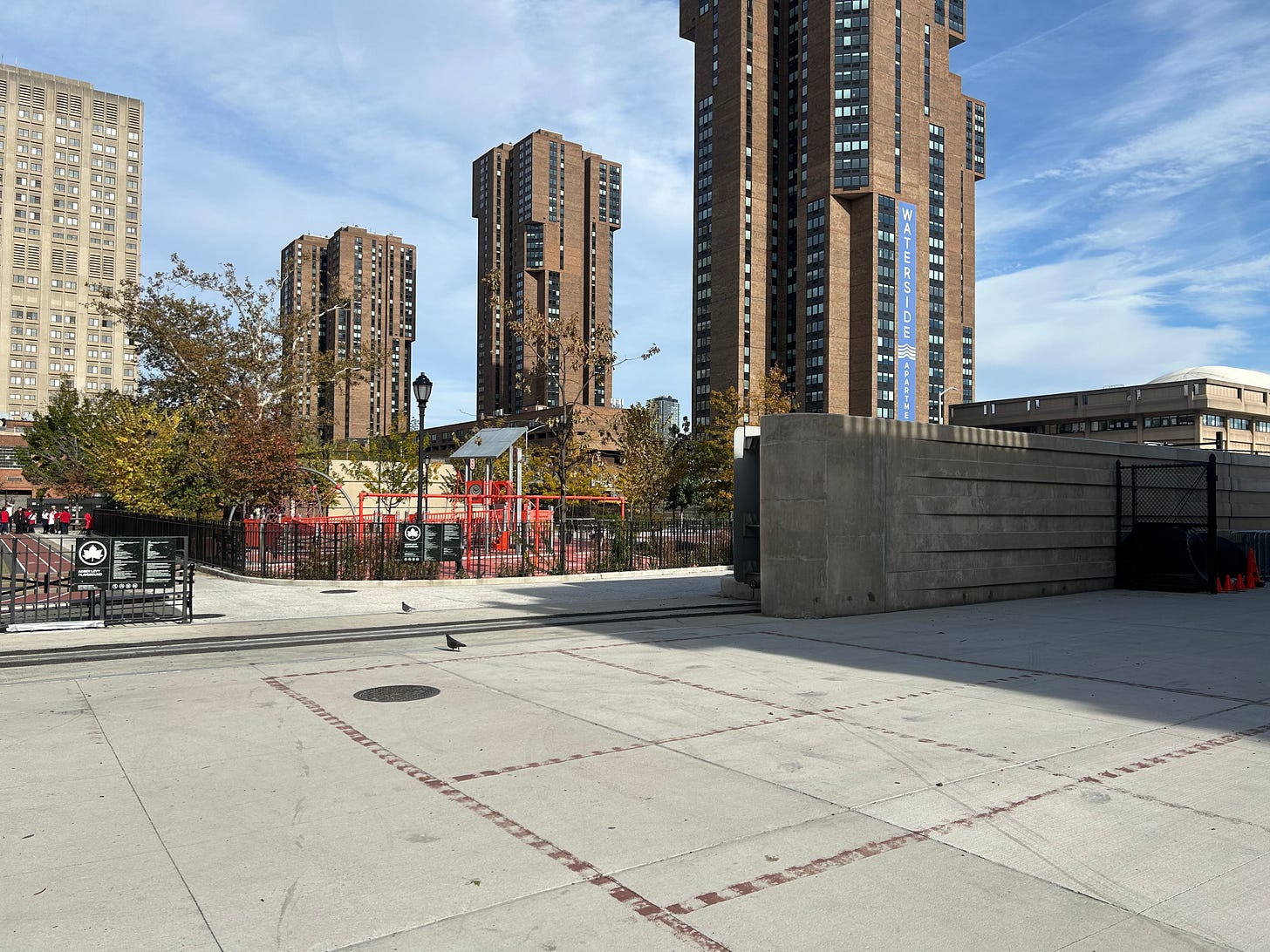
Stuyvesant Cove was among the first sites built, due to its concentration of public housing and vulnerability during Hurricane Sandy. With public pressure, the City determined that this hard-hit area should receive flooding protection first.
South of 14th Street, 88 flip gates will replace the standing gates used farther north; many double as walkways when open.
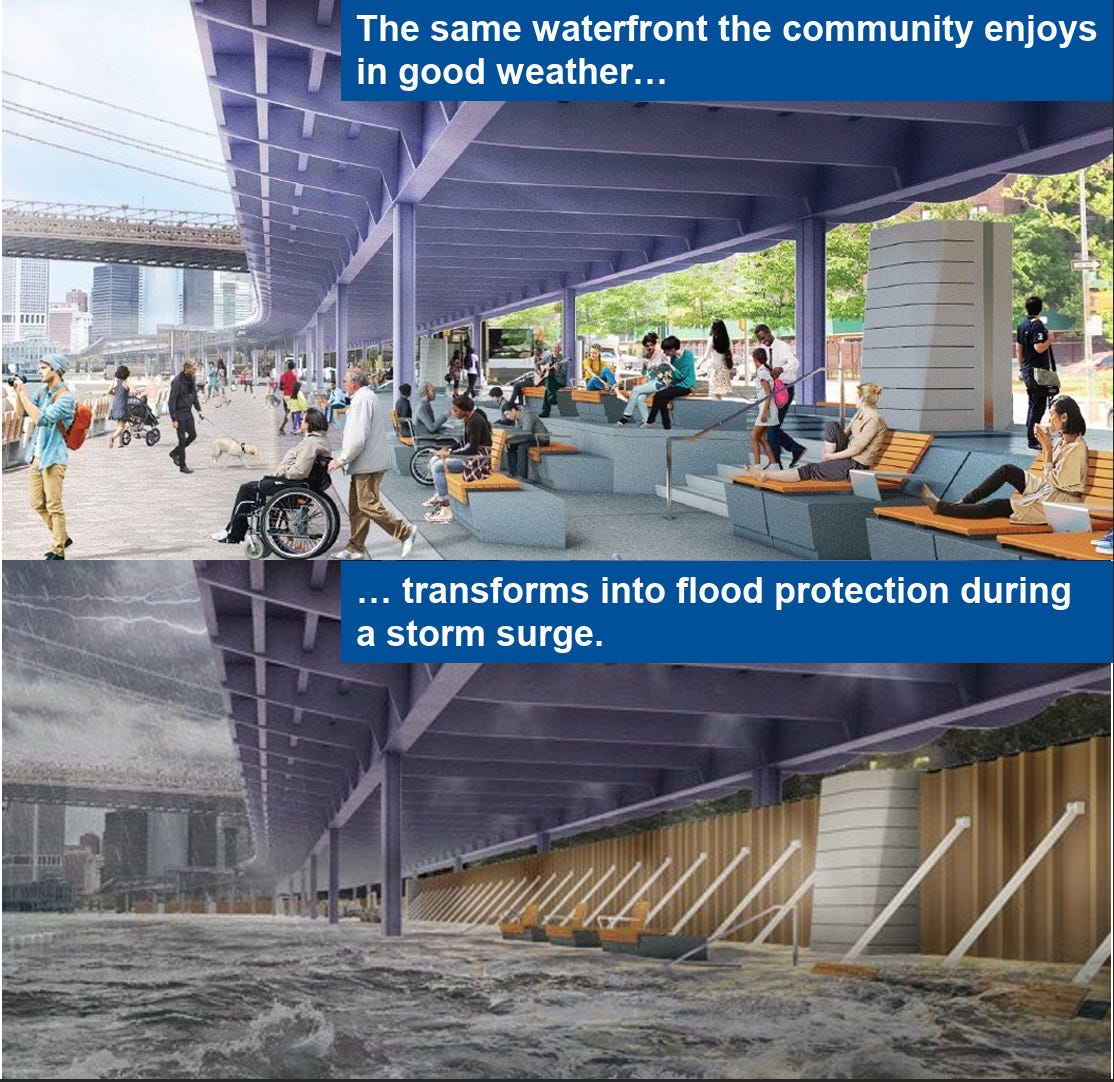
Generated images of DEP’s floodgates under the FDR in FiDi, currently under construction. [source] Floodgate 13, one of the largest, was designed for maximum pedestrian and vehicle access. DEP later moved away from creating such large gates, finding smaller, center-post designs more practical for maintenance and operation.
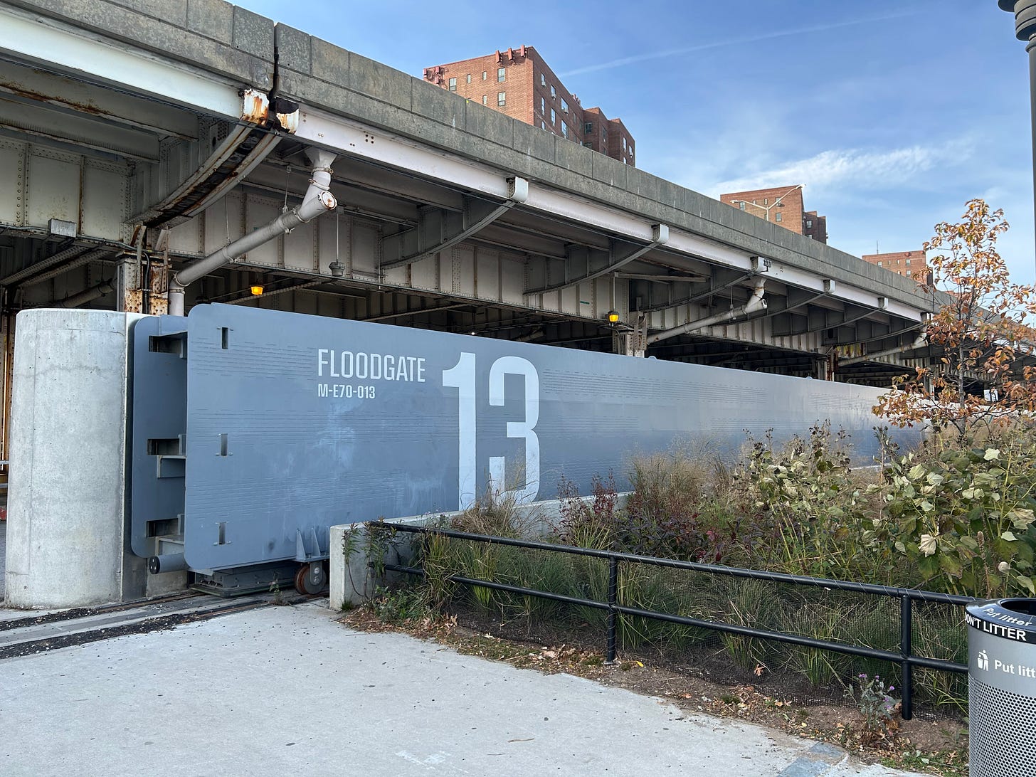
Every gate is slightly different, making it difficult to create uniform operating standards. Differences include seal mechanisms, timing, and materials.
NYC procurement rules required four separate designers, which contributed to these variations.
DEP is training specialized crews to operate the gates during emergencies, but is mindful of maintaining cost efficiency since the gates are rarely active. Workers are being cross-trained to support other DEP projects so that the financial costs of maintaining these crews are justified.

5. Engineering and Design Details
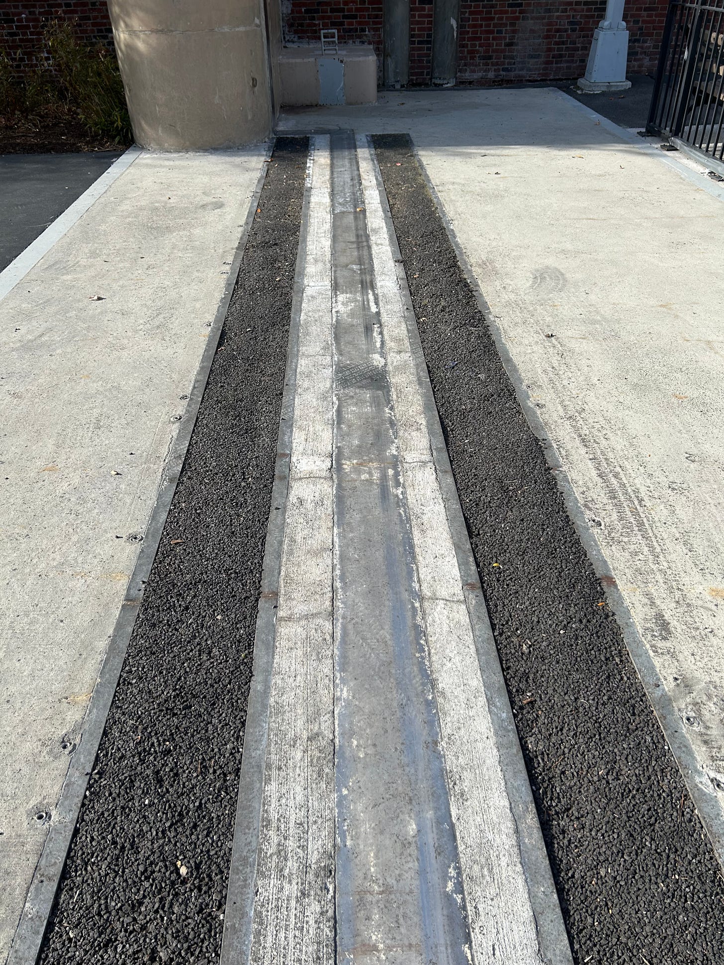
Ensuring the gate rails don’t become tripping hazards was a key design challenge. They tested multiple methods and settled on using an asphalt filler (same material as what’s used for potholes), which can be installed or removed in about an hour.
The wave patterns on flood walls are purely aesthetic, designed so the motion appears consistent whether viewed by pedestrians walking down the street or cars traveling on the FDR.
The minutiae of design mattered: at one point, a contractor used the wrong paint material, causing corrosion on the metal grating in Stuyvesant Cove, which had to be replaced.


6. Managing the Infrastructure
DEP manages the floodgates but partners with other agencies for upkeep:
Sanitation handles trash accumulation and helps with removing graffiti.
NYC Ferry manages certain gates and flood walls in Stuyvesant Cove, where there is a ferry stop.
Graffiti and homeless individuals seeking shelter in the gate areas are two of the largest current challenges. DEP works with DHS and NYPD to relocate people prior to gate maintenance events, acknowledging that this is a short-term maintenance solution, not a housing fix.
ESCR flood walls protect about 180,000 residents and multiple hospitals along the east side.
Because of these protections, future developments within the ESCR zone will not be required to purchase flood insurance, leading to significant cost savings for new buildings.
7. Coordination, Policy, and Planning
FEMA has approved all ESCR designs. DEP must report back every five years to maintain accreditation on the floodwalls.
The Army Corps of Engineers is designing storm surge barriers in Jamaica Bay, now in the feasibility stage. Since they’ll span both New York and New Jersey, operational and funding responsibilities remain under discussion.
The Army Corps of Engineers used to manage national coastal emergency efforts, but its funding was recently paused under the Trump administration, leaving its role in the future uncertain.
Proposals for offshore barriers near the Verrazzano-Narrows, at the entrance to New York Harbor, were ruled out due to high costs and ecological concerns.
The passage of the 2025 ballot proposal that expedites ULURP for climate infrastructure projects has been a “game-changer,” cutting down approval delays. Previously, projects being stuck in the ULURP process for long periods of time resulted in significant uncertainty for approval which slowed down work.
Current plans tell DEP where and how they can build, but not where they should. They’re now coordinating with other agencies to integrate resiliency concerns into housing and development planning, which could potentially mean advising against new housing in high-risk areas.
Cities are taking different approaches to coastal resilience: Miami is elevating roadways, Amsterdam uses offshore barriers, London operates the Thames flood barrier, and NYC is now building its own system.
Every design involves trade-offs - decisions about what can reasonably be protected versus what cannot.
In areas like the Rockaways, the city chose to buy out properties hit by Hurricane Sandy to prevent rebuilding in high-risk zones.
These notes have been lightly edited by AI to correct grammar and clean up sentence structure.
Great overview. I run past this work all the time and appreciate learning some of its intricacies. Thanks!